
Thank you for supporting this site ❤️
Make a donation
Make a donation
Granger Township topographic map
Click on the map to display elevation.
Thank you for supporting this site ❤️
Make a donation
Make a donation
About this map
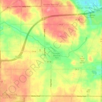
Name: Granger Township topographic map, elevation, terrain.
Location: Granger Township, Medina County, Ohio, United States (41.13596 -81.78490 41.20213 -81.68581)
Average elevation: 342 m
Minimum elevation: 289 m
Maximum elevation: 386 m
Thank you for supporting this site ❤️
Make a donation
Make a donation
Other topographic maps
Click on a map to view its topography, its elevation and its terrain.