
Thank you for supporting this site ❤️
Make a donation
Make a donation
Cribyn topographic map
Click on the map to display elevation.
Thank you for supporting this site ❤️
Make a donation
Make a donation
About this map
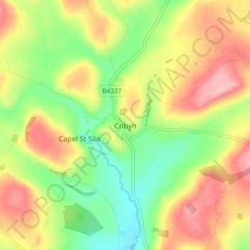
Name: Cribyn topographic map, elevation, terrain.
Location: Cribyn, Ceredigion, Wales, SA48 7NB, United Kingdom (52.11856 -4.18066 52.15856 -4.14066)
Average elevation: 195 m
Minimum elevation: 128 m
Maximum elevation: 268 m
Thank you for supporting this site ❤️
Make a donation
Make a donation