
Thank you for supporting this site ❤️
Make a donation
Make a donation
Enghien topographic map
Click on the map to display elevation.
Thank you for supporting this site ❤️
Make a donation
Make a donation
About this map
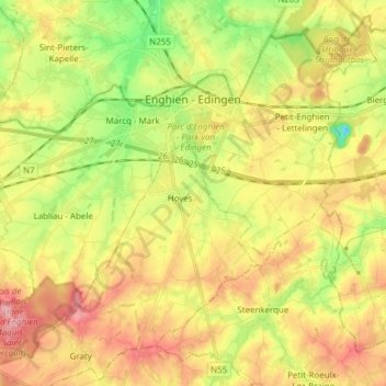
Name: Enghien topographic map, elevation, terrain.
Location: Enghien, Ath, Hainaut, Wallonia, Belgium (50.63072 3.96127 50.71351 4.11410)
Average elevation: 68 m
Minimum elevation: 4 m
Maximum elevation: 130 m
Thank you for supporting this site ❤️
Make a donation
Make a donation
Other topographic maps
Click on a map to view its topography, its elevation and its terrain.