
Thank you for supporting this site ❤️
Make a donation
Make a donation
Swords topographic map
Click on the map to display elevation.
Thank you for supporting this site ❤️
Make a donation
Make a donation
Swords
At the northern end of the street stands Swords Castle, 200m northeast of the ecclesiastical site, which was built in the early 13th century. A short distance north of the castle is the elevation known as Spittal Hill, where a hospital once stood.
Thank you for supporting this site ❤️
Make a donation
Make a donation
About this map
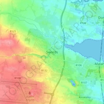
Name: Swords topographic map, elevation, terrain.
Location: Swords, Fingal, County Dublin, Leinster, K67 X8Y2, Ireland (53.41983 -6.25846 53.49983 -6.17846)
Average elevation: 28 m
Minimum elevation: -19 m
Maximum elevation: 80 m
Thank you for supporting this site ❤️
Make a donation
Make a donation