
Thank you for supporting this site ❤️
Make a donation
Make a donation
Harelbeke topographic map
Click on the map to display elevation.
Thank you for supporting this site ❤️
Make a donation
Make a donation
About this map
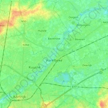
Name: Harelbeke topographic map, elevation, terrain.
Location: Harelbeke, Kortrijk, West Flanders, Flanders, Belgium (50.81798 3.26729 50.90734 3.34926)
Average elevation: 17 m
Minimum elevation: 5 m
Maximum elevation: 40 m
Thank you for supporting this site ❤️
Make a donation
Make a donation
Other topographic maps
Click on a map to view its topography, its elevation and its terrain.