
苏哇龙乡 topographic map
Interactive map
Click on the map to display elevation.
About this map
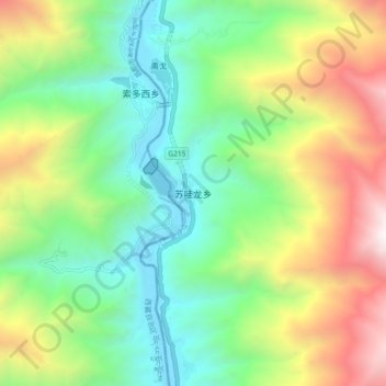
Name: 苏哇龙乡 topographic map, elevation, terrain.
Location: 苏哇龙乡, 巴塘县, 甘孜藏族自治州, 四川省, 中国 (29.39090 99.02955 29.47090 99.10955)
Average elevation: 3,240 m
Minimum elevation: 2,376 m
Maximum elevation: 4,824 m
Other topographic maps
Click on a map to view its topography, its elevation and its terrain.