
Thank you for supporting this site ❤️
Make a donation
Make a donation
Fujiyoshida topographic map
Click on the map to display elevation.
Thank you for supporting this site ❤️
Make a donation
Make a donation
Fujiyoshida
Fujiyoshida lies at the northern base of Mount Fuji, and is built upon old lava flows. It is considered a high-elevation city in Japan, at 650 to 850 metres (2,140 to 2,800 feet) above sea level. The city is also located between two of the Fuji Five Lakes. The Katsura River flows through the eastern part of the city.
Thank you for supporting this site ❤️
Make a donation
Make a donation
About this map
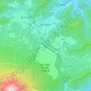
Name: Fujiyoshida topographic map, elevation, terrain.
Location: Fujiyoshida, Yamanashi Prefecture, Chubu Region, Japan (35.36449 138.72759 35.53275 138.86622)
Average elevation: 1,161 m
Minimum elevation: 556 m
Maximum elevation: 3,744 m
Thank you for supporting this site ❤️
Make a donation
Make a donation
Other topographic maps
Click on a map to view its topography, its elevation and its terrain.