
Thank you for supporting this site ❤️
Make a donation
Make a donation
Farrington topographic map
Click on the map to display elevation.
Thank you for supporting this site ❤️
Make a donation
Make a donation
About this map
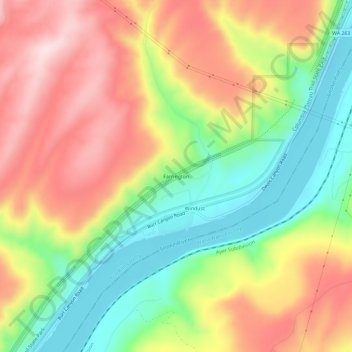
Name: Farrington topographic map, elevation, terrain.
Location: Farrington, Franklin County, Washington, United States (46.51958 -118.59860 46.55958 -118.55860)
Average elevation: 294 m
Minimum elevation: 124 m
Maximum elevation: 474 m
Thank you for supporting this site ❤️
Make a donation
Make a donation
Other topographic maps
Click on a map to view its topography, its elevation and its terrain.