
Thank you for supporting this site ❤️
Make a donation
Make a donation
Mesa topographic map
Click on the map to display elevation.
Thank you for supporting this site ❤️
Make a donation
Make a donation
About this map
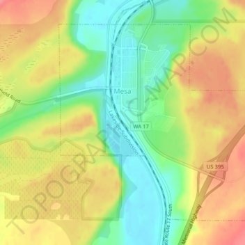
Name: Mesa topographic map, elevation, terrain.
Location: Mesa, Franklin County, Washington, United States (46.56196 -119.01689 46.58363 -118.98554)
Average elevation: 239 m
Minimum elevation: 200 m
Maximum elevation: 278 m
Thank you for supporting this site ❤️
Make a donation
Make a donation
Other topographic maps
Click on a map to view its topography, its elevation and its terrain.