
Thank you for supporting this site ❤️
Make a donation
Make a donation
Harder topographic map
Click on the map to display elevation.
Thank you for supporting this site ❤️
Make a donation
Make a donation
About this map
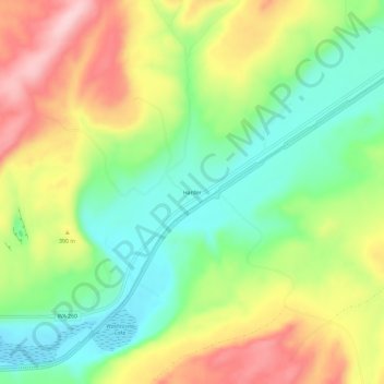
Name: Harder topographic map, elevation, terrain.
Location: Harder, Franklin County, Washington, United States (46.64344 -118.50744 46.68344 -118.46744)
Average elevation: 350 m
Minimum elevation: 262 m
Maximum elevation: 466 m
Thank you for supporting this site ❤️
Make a donation
Make a donation
Other topographic maps
Click on a map to view its topography, its elevation and its terrain.