
Thank you for supporting this site ❤️
Make a donation
Make a donation
Fancy Hill topographic map
Click on the map to display elevation.
Thank you for supporting this site ❤️
Make a donation
Make a donation
About this map
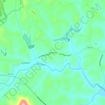
Name: Fancy Hill topographic map, elevation, terrain.
Location: Fancy Hill, Amherst County, Virginia, 24512, United States (37.64792 -79.14669 37.68792 -79.10669)
Average elevation: 234 m
Minimum elevation: 184 m
Maximum elevation: 394 m
Thank you for supporting this site ❤️
Make a donation
Make a donation
Other topographic maps
Click on a map to view its topography, its elevation and its terrain.