
Thank you for supporting this site ❤️
Make a donation
Make a donation
Olalla topographic map
Click on the map to display elevation.
Thank you for supporting this site ❤️
Make a donation
Make a donation
About this map
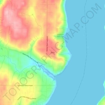
Name: Olalla topographic map, elevation, terrain.
Location: Olalla, Kitsap County, Washington, 98359, United States (47.41054 -122.56295 47.45054 -122.52295)
Average elevation: 48 m
Minimum elevation: -4 m
Maximum elevation: 141 m
Thank you for supporting this site ❤️
Make a donation
Make a donation
Other topographic maps
Click on a map to view its topography, its elevation and its terrain.
Manitou Beach Park
United States > Washington > Kitsap County > Bainbridge Island
Average elevation: 27 m
Thank you for supporting this site ❤️
Make a donation
Make a donation
Bainbridge Island
United States > Washington > Kitsap County > Bainbridge Island
Average elevation: 29 m
Thank you for supporting this site ❤️
Make a donation
Make a donation