
Thank you for supporting this site ❤️
Make a donation
Make a donation
Sisco Heights topographic map
Click on the map to display elevation.
Thank you for supporting this site ❤️
Make a donation
Make a donation
About this map
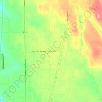
Name: Sisco Heights topographic map, elevation, terrain.
Location: Sisco Heights, Snohomish County, Washington, United States (48.09538 -122.11708 48.13538 -122.07708)
Average elevation: 132 m
Minimum elevation: 70 m
Maximum elevation: 199 m
Thank you for supporting this site ❤️
Make a donation
Make a donation
Other topographic maps
Click on a map to view its topography, its elevation and its terrain.
Thank you for supporting this site ❤️
Make a donation
Make a donation
Thank you for supporting this site ❤️
Make a donation
Make a donation
Seattle Hill-Silver Firs
United States > Washington > Snohomish County > Seattle Hill-Silver Firs
Average elevation: 93 m
Thank you for supporting this site ❤️
Make a donation
Make a donation