
Thank you for supporting this site ❤️
Make a donation
Make a donation
West Parley topographic map
Click on the map to display elevation.
Thank you for supporting this site ❤️
Make a donation
Make a donation
About this map
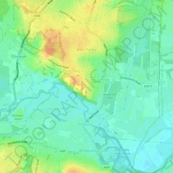
Name: West Parley topographic map, elevation, terrain.
Location: West Parley, Dorset, England, United Kingdom (50.76339 -1.89598 50.79618 -1.86449)
Average elevation: 17 m
Minimum elevation: 4 m
Maximum elevation: 39 m
Thank you for supporting this site ❤️
Make a donation
Make a donation
Other topographic maps
Click on a map to view its topography, its elevation and its terrain.