
Thank you for supporting this site ❤️
Make a donation
Make a donation
North Lunenburg topographic map
Click on the map to display elevation.
Thank you for supporting this site ❤️
Make a donation
Make a donation
About this map
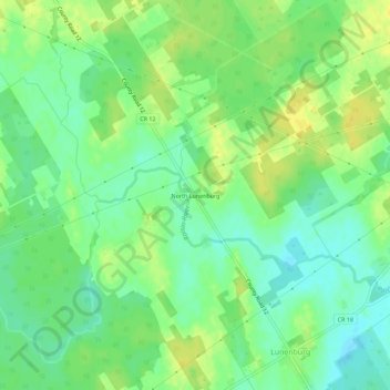
Name: North Lunenburg topographic map, elevation, terrain.
Average elevation: 87 m
Minimum elevation: 76 m
Maximum elevation: 97 m
Thank you for supporting this site ❤️
Make a donation
Make a donation
Other topographic maps
Click on a map to view its topography, its elevation and its terrain.
McLaren Island
Canada > Ontario > Stormont, Dundas and Glengarry Counties > South Stormont > Ingleside
Average elevation: 74 m