
Alibates Flint Quarries National Monument topographic map
Interactive map
Click on the map to display elevation.
About this map
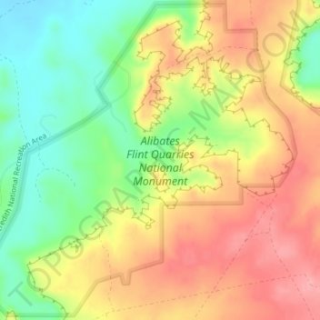
Name: Alibates Flint Quarries National Monument topographic map, elevation, terrain.
Average elevation: 947 m
Minimum elevation: 890 m
Maximum elevation: 998 m
Other topographic maps
Click on a map to view its topography, its elevation and its terrain.
Amarillo
United States > Texas > Potter County
Amarillo, Potter County, Texas, United States
Average elevation: 1,097 m
Amarillo
United States > Texas > Potter County
Amarillo, Potter County, Texas, United States
Average elevation: 1,097 m
Bushland
United States > Texas > Potter County
Bushland, Potter County, Texas, 79012, United States
Average elevation: 1,166 m
Amarillo
United States > Texas > Potter County > Amarillo
Amarillo, Potter County, Texas, 79105, United States
Average elevation: 1,090 m