
Mount Una topographic map
Click on the map to display elevation.
About this map
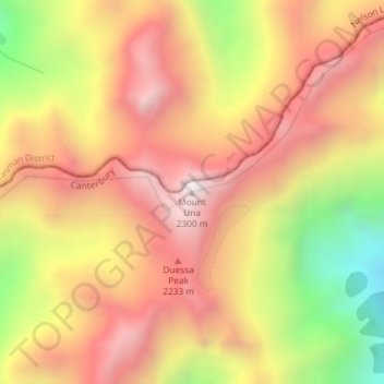
Name: Mount Una topographic map, elevation, terrain.
Location: Mount Una, Hurunui District, New Zealand (-42.21687 172.58516 -42.21677 172.58526)
Average elevation: 1,816 m
Minimum elevation: 1,159 m
Maximum elevation: 2,270 m
Other topographic maps
Click on a map to view its topography, its elevation and its terrain.