
Thank you for supporting this site ❤️
Make a donation
Make a donation
Yarrow topographic map
Click on the map to display elevation.
Thank you for supporting this site ❤️
Make a donation
Make a donation
About this map
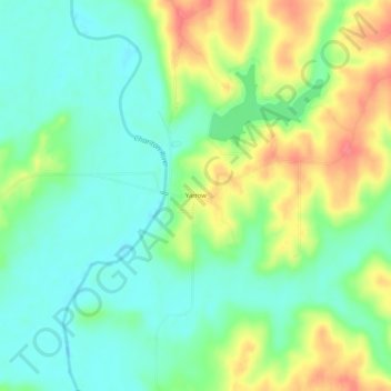
Name: Yarrow topographic map, elevation, terrain.
Location: Yarrow, Adair County, Missouri, United States (40.07392 -92.70047 40.11392 -92.66047)
Average elevation: 245 m
Minimum elevation: 220 m
Maximum elevation: 285 m
Thank you for supporting this site ❤️
Make a donation
Make a donation
Other topographic maps
Click on a map to view its topography, its elevation and its terrain.