
Thank you for supporting this site ❤️
Make a donation
Make a donation
Cordes Lake topographic map
Click on the map to display elevation.
Thank you for supporting this site ❤️
Make a donation
Make a donation
About this map
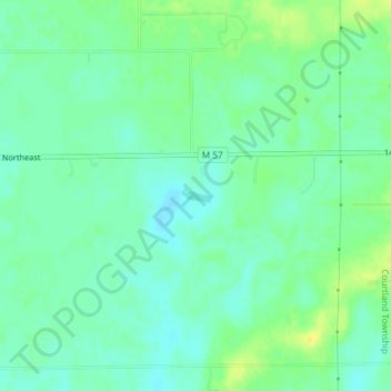
Name: Cordes Lake topographic map, elevation, terrain.
Average elevation: 275 m
Minimum elevation: 266 m
Maximum elevation: 289 m
Thank you for supporting this site ❤️
Make a donation
Make a donation
Other topographic maps
Click on a map to view its topography, its elevation and its terrain.
Thank you for supporting this site ❤️
Make a donation
Make a donation
Thank you for supporting this site ❤️
Make a donation
Make a donation
Thank you for supporting this site ❤️
Make a donation
Make a donation
Northview
United States > Michigan > Kent County > Plainfield Charter Township
Average elevation: 216 m
Comstock Park
United States > Michigan > Kent County > Plainfield Charter Township
Average elevation: 206 m
Thank you for supporting this site ❤️
Make a donation
Make a donation
Thank you for supporting this site ❤️
Make a donation
Make a donation