
Thank you for supporting this site ❤️
Make a donation
Make a donation
Thamesford topographic map
Click on the map to display elevation.
Thank you for supporting this site ❤️
Make a donation
Make a donation
About this map
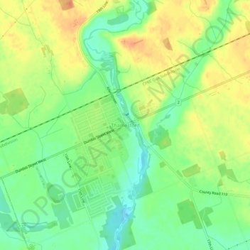
Name: Thamesford topographic map, elevation, terrain.
Location: Thamesford, Zorra, Oxford County, Ontario, N0M 2M0, Canada (43.03889 -81.01631 43.07889 -80.97631)
Average elevation: 291 m
Minimum elevation: 271 m
Maximum elevation: 312 m
Thank you for supporting this site ❤️
Make a donation
Make a donation