
Thank you for supporting this site ❤️
Make a donation
Make a donation
Isabella topographic map
Click on the map to display elevation.
Thank you for supporting this site ❤️
Make a donation
Make a donation
About this map
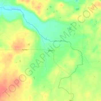
Name: Isabella topographic map, elevation, terrain.
Location: Isabella, Lake County, Minnesota, United States (47.59713 -91.37487 47.63713 -91.33487)
Average elevation: 594 m
Minimum elevation: 566 m
Maximum elevation: 619 m
Thank you for supporting this site ❤️
Make a donation
Make a donation
Other topographic maps
Click on a map to view its topography, its elevation and its terrain.
Boundary Waters Canoe Area Wilderness
United States > Minnesota > Lake County
Average elevation: 423 m
Thank you for supporting this site ❤️
Make a donation
Make a donation
Thank you for supporting this site ❤️
Make a donation
Make a donation