
Thank you for supporting this site ❤️
Make a donation
Make a donation
Unahala topographic map
Click on the map to display elevation.
Thank you for supporting this site ❤️
Make a donation
Make a donation
About this map
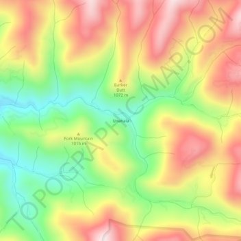
Name: Unahala topographic map, elevation, terrain.
Location: Unahala, Swain County, North Carolina, United States (35.33482 -83.42988 35.37482 -83.38988)
Average elevation: 975 m
Minimum elevation: 688 m
Maximum elevation: 1,263 m
Thank you for supporting this site ❤️
Make a donation
Make a donation
Other topographic maps
Click on a map to view its topography, its elevation and its terrain.