
Make a donation
Guanajuato topographic map
Click on the map to display elevation.
Make a donation
Guanajuato
Although only one out of every 100 bodies interred in the cemetery became naturally mummified, the concentration of this phenomenon has led to theories about how they have come about.[33] Some believe that they are the result of people who had been buried alive, after mistakenly declared dead. These people, according to belief, died of desperation and asphyxiation and as a sign of their pain, convert into mummies.[35] More commonly, it is likely the result of Guanjuato's altitude or the abundance of minerals in the soil. However, all of the mummified remains were found in the cemetery's above ground cement crypts, not in underground graves.[34][35] Researchers believe the phenomenon is due to the warm, dry climate of the area, which dried out the bodies rapidly.[34]
Make a donation
About this map
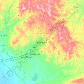
Name: Guanajuato topographic map, elevation, terrain.
Average elevation: 2,182 m
Minimum elevation: 1,750 m
Maximum elevation: 2,942 m
Make a donation