

Mexico topographic maps
Click on a map to view its topography, its elevation and its terrain.


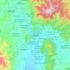
Oaxaca City
Mexico > Oaxaca > Oaxaca de Juárez
Oaxaca has a tropical savanna climate (Köppen climate classification Aw), closely bordering on a humid subtropical climate (Cwa), due to its high altitude. During the dry season, temperatures during the day remain warm with an average high of 27.1 °C (80.8 °F) in the coolest month, December, and an average…
Average elevation: 1,838 m
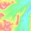

Guadalajara
Under the Köppen climate classification, Guadalajara has a humid subtropical climate (Cwa), a temperate climate that is quite close to a tropical climate, featuring dry warm winters and wet, mildly hot summers. Guadalajara's climate is influenced by its high altitude and the general seasonality of…
Average elevation: 1,543 m

Nuevo León
The state's southern and western scenery is dominated by the Sierra Madre Oriental mountain range, covering 50.9% of the state's territory. Notable features formed by the mountain range include the Galeana and Doctor Arroyo plateaus, the Iguana, Picachos, Papagayos, and Santa Clara mountain ranges, and the…
Average elevation: 805 m