
Thank you for supporting this site ❤️
Make a donation
Make a donation
East Peoria topographic map
Click on the map to display elevation.
Thank you for supporting this site ❤️
Make a donation
Make a donation
About this map
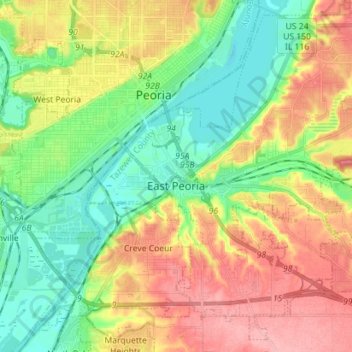
Name: East Peoria topographic map, elevation, terrain.
Location: East Peoria, Tazewell County, Illinois, 61611, United States (40.61927 -89.61607 40.71907 -89.47482)
Average elevation: 176 m
Minimum elevation: 129 m
Maximum elevation: 238 m
Thank you for supporting this site ❤️
Make a donation
Make a donation
Other topographic maps
Click on a map to view its topography, its elevation and its terrain.