
Make a donation
Cape Sable topographic map
Click on the map to display elevation.
Make a donation
About this map
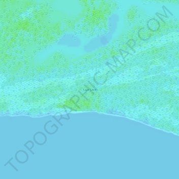
Name: Cape Sable topographic map, elevation, terrain.
Location: Cape Sable, Monroe County, Florida, United States (25.13285 -81.02735 25.13295 -81.02725)
Average elevation: 2 m
Minimum elevation: 0 m
Maximum elevation: 8 m
Make a donation
Other topographic maps
Click on a map to view its topography, its elevation and its terrain.
Hudson
United States > Florida > Hudson
Hudson features a predominantly flat and low-lying topography typical of the region, with an average elevation of approximately 16 feet above sea level. This terrain is interspersed with various wetlands and small lakes, creating a rich ecosystem that supports diverse wildlife. The area also includes a few…
Average elevation: 5 m
Eglin Air Force Base
United States > Florida > Okaloosa County
Eglin is known to have been used for 441 launches from 1959 to 1980, reaching up to 686 kilometers altitude.
Average elevation: 12 m
Make a donation
Make a donation
Make a donation
Make a donation
Make a donation
Lake Avalon
United States > Florida > Orange County > Winter Garden > Lake Avalon Rural Settlement
Average elevation: 40 m
Graceville
United States > Florida > Jackson County
Jackson County is a rural community primarily composed of business in agriculture, manufacturing, service, and retail trade. In addition, many government facilities are located within the county, including a federal prison and three state correctional institutions. Elevation ranges from 50 to 330 feet (100 m)…
Average elevation: 48 m
Make a donation
Make a donation
Make a donation
South Fork New River
United States > Florida > Broward County > Fort Lauderdale
Average elevation: 7 m
Make a donation
Make a donation
Torreya State Park
United States > Florida > Liberty County
With river swamps and high pinelands, extensive ravines and high bluffs along the river, the park has one of the most variable terrains of any in Florida. The high elevation of the park is about 300 feet at the top of Logan Hill. Many streams run through the park.
Average elevation: 47 m
Alice C Wainwright Park
United States > Florida > Miami-Dade County > Miami > Brickell Hammock
Average elevation: 6 m
Make a donation
Make a donation
Castillo de San Marcos
United States > Florida > Saint Johns County > Saint Augustine
Average elevation: 2 m
Montverde
United States > Florida > Lake County
Montverde is located in southeastern Lake County at 28°35′58″N 81°40′34″W / 28.599476°N 81.676221°W / 28.599476; -81.676221, on the southwest shore of Lake Apopka. The town sits on hills that rise 50 to 100 feet (15 to 30 m) above the elevation of the lake. It is 18 miles (29 km) south of…
Average elevation: 27 m
Make a donation
Make a donation
Make a donation
Make a donation
Make a donation
Make a donation
Make a donation
Make a donation
Make a donation
Make a donation
Make a donation
Make a donation
Make a donation