
Thank you for supporting this site ❤️
Make a donation
Make a donation
Cabanillas topographic map
Click on the map to display elevation.
Thank you for supporting this site ❤️
Make a donation
Make a donation
About this map
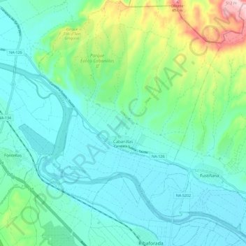
Name: Cabanillas topographic map, elevation, terrain.
Location: Cabanillas, Ribera, Navarra, 31511, España (41.99713 -1.56610 42.08106 -1.48034)
Average elevation: 295 m
Minimum elevation: 237 m
Maximum elevation: 507 m
Thank you for supporting this site ❤️
Make a donation
Make a donation
Other topographic maps
Click on a map to view its topography, its elevation and its terrain.