
Thank you for supporting this site ❤️
Make a donation
Make a donation
Gomukh, Ice Cave topographic map
Click on the map to display elevation.
Thank you for supporting this site ❤️
Make a donation
Make a donation
Gomukh, Ice Cave
Around the snout, nature presents a wild topography. There are boulders scattered here and there with some pieces of broken snow, along with the hard clayey snow of the glacier.
Thank you for supporting this site ❤️
Make a donation
Make a donation
About this map
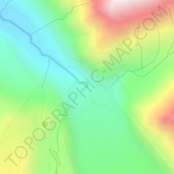
Name: Gomukh, Ice Cave topographic map, elevation, terrain.
Average elevation: 4,286 m
Minimum elevation: 3,888 m
Maximum elevation: 4,989 m
Thank you for supporting this site ❤️
Make a donation
Make a donation
Other topographic maps
Click on a map to view its topography, its elevation and its terrain.
Thank you for supporting this site ❤️
Make a donation
Make a donation
Thank you for supporting this site ❤️
Make a donation
Make a donation