
Netherlands topographic map
Interactive map
Click on the map to display elevation.
About this map
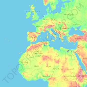
Name: Netherlands topographic map, elevation, terrain.
Location: Netherlands (11.77700 -70.26959 53.74403 7.22750)
Average elevation: 253 m
Minimum elevation: -27 m
Maximum elevation: 3,972 m
Netherlands literally means 'lower countries' in reference to its low elevation and flat topography, with only about 50% of its land exceeding 1 metre (3 ft 3 in) above sea level, and nearly 17% falling below sea level. Most of the areas below sea level, known as polders, are the result of land reclamation that began in the 16th century. With a population of 17.4 million people, all living within a total area of roughly 41,800 square kilometres (16,100 sq mi)—of which the land area is 33,500 square kilometres (12,900 sq mi)—the Netherlands is the 12th most densely populated country in the world and the 5th most densely populated country in Europe, with a density of 521 per square kilometre (1,350/sq mi). Nevertheless, it is the world's second-largest exporter of food and agricultural products (after the United States), owing to its fertile soil, mild climate, intensive agriculture and inventiveness.
Other topographic maps
Click on a map to view its topography, its elevation and its terrain.
Achtmaal
Achtmaal, Zundert, North Brabant, Netherlands
Average elevation: 13 m
Boskoop
Boskoop, Alphen aan den Rijn, South Holland, Netherlands
Average elevation: -2 m
Voorburg
Voorburg, Leidschendam-Voorburg, South Holland, Netherlands
Average elevation: 3 m
Zoetermeer
Netherlands > South Holland > Zoetermeer
Zoetermeer, South Holland, Netherlands
Average elevation: -3 m
Amsterdam
Netherlands > North Holland > Amsterdam
Amsterdam, North Holland, Netherlands
Average elevation: 0 m
Velserbroek
Netherlands > North Holland > Velsen > Velserbroek
Velserbroek, Velsen, North Holland, Netherlands
Average elevation: 3 m