
Thank you for supporting this site ❤️
Make a donation
Make a donation
Nespelem topographic map
Click on the map to display elevation.
Thank you for supporting this site ❤️
Make a donation
Make a donation
About this map
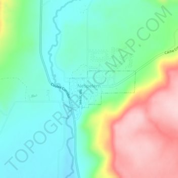
Name: Nespelem topographic map, elevation, terrain.
Location: Nespelem, Okanogan County, Washington, United States (48.16380 -118.97928 48.16938 -118.96414)
Average elevation: 615 m
Minimum elevation: 535 m
Maximum elevation: 774 m
Thank you for supporting this site ❤️
Make a donation
Make a donation
Other topographic maps
Click on a map to view its topography, its elevation and its terrain.
Thank you for supporting this site ❤️
Make a donation
Make a donation
Thank you for supporting this site ❤️
Make a donation
Make a donation