
Thank you for supporting this site ❤️
Make a donation
Make a donation
Holmes Mill topographic map
Click on the map to display elevation.
Thank you for supporting this site ❤️
Make a donation
Make a donation
About this map
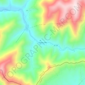
Name: Holmes Mill topographic map, elevation, terrain.
Location: Holmes Mill, Harlan County, Kentucky, 40843, United States (36.84842 -83.02239 36.88842 -82.98239)
Average elevation: 758 m
Minimum elevation: 511 m
Maximum elevation: 1,143 m
Thank you for supporting this site ❤️
Make a donation
Make a donation
Other topographic maps
Click on a map to view its topography, its elevation and its terrain.