
大水坑镇 topographic map
Interactive map
Click on the map to display elevation.
About this map
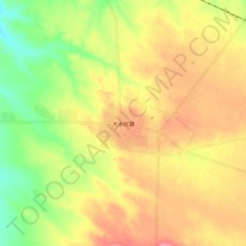
Name: 大水坑镇 topographic map, elevation, terrain.
Location: 大水坑镇, 盐池县, 吴忠市, 宁夏回族自治区, 中国 (37.40099 106.91521 37.48099 106.99521)
Average elevation: 1,539 m
Minimum elevation: 1,484 m
Maximum elevation: 1,586 m
Other topographic maps
Click on a map to view its topography, its elevation and its terrain.