
游仙区 topographic map
Interactive map
Click on the map to display elevation.
About this map
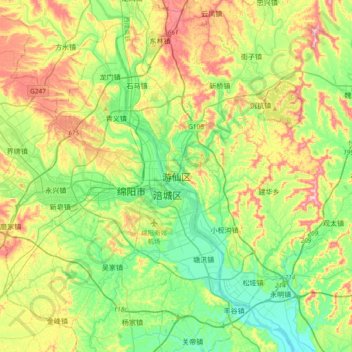
Name: 游仙区 topographic map, elevation, terrain.
Location: 游仙区, 绵阳市, 四川省, 621000, 中国 (31.31343 104.60436 31.63343 104.92436)
Average elevation: 509 m
Minimum elevation: 416 m
Maximum elevation: 677 m
Other topographic maps
Click on a map to view its topography, its elevation and its terrain.