
Make a donation
Viking Quarry Lake topographic map
Click on the map to display elevation.
Make a donation
About this map
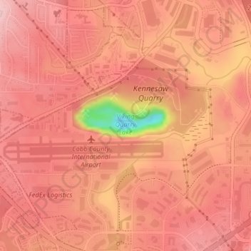
Name: Viking Quarry Lake topographic map, elevation, terrain.
Location: Viking Quarry Lake, Cobb County, Georgia, United States (34.01451 -84.59792 34.01711 -84.58491)
Average elevation: 303 m
Minimum elevation: 166 m
Maximum elevation: 340 m
Make a donation
Other topographic maps
Click on a map to view its topography, its elevation and its terrain.
Kennesaw Mountain
United States > Georgia > Cobb County
Kennesaw Mountain is a mountain between Marietta and Kennesaw, Georgia in the United States with a summit elevation of 1,808 feet (551 m). It is the highest point in the core (urban and suburban) metro Atlanta area, and fifth after further-north exurban counties are considered. The local terrain averages…
Average elevation: 360 m
Make a donation
Kennesaw
United States > Georgia > Cobb County > Kennesaw
Kennesaw is located in northwestern Cobb County, bordered by the city of Acworth to the northwest. Kennesaw Mountain is located southeast of the city limits in the battlefield park. Its summit is the highest point in the Atlanta metro area, at an elevation of 1,808 feet (551 m) above sea level. The city was…
Average elevation: 318 m
Make a donation