
Thank you for supporting this site ❤️
Make a donation
Make a donation
Nemaha County topographic map
Click on the map to display elevation.
Thank you for supporting this site ❤️
Make a donation
Make a donation
About this map
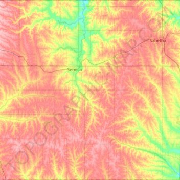
Name: Nemaha County topographic map, elevation, terrain.
Location: Nemaha County, Kansas, United States (39.56595 -96.23957 40.00094 -95.78809)
Average elevation: 382 m
Minimum elevation: 311 m
Maximum elevation: 438 m
Thank you for supporting this site ❤️
Make a donation
Make a donation
Other topographic maps
Click on a map to view its topography, its elevation and its terrain.