
Thank you for supporting this site ❤️
Make a donation
Make a donation
Winesap topographic map
Click on the map to display elevation.
Thank you for supporting this site ❤️
Make a donation
Make a donation
About this map
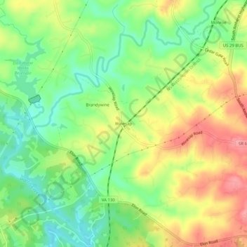
Name: Winesap topographic map, elevation, terrain.
Location: Winesap, Amherst County, Virginia, 24572, United States (37.46570 -79.16725 37.50570 -79.12725)
Average elevation: 226 m
Minimum elevation: 182 m
Maximum elevation: 278 m
Thank you for supporting this site ❤️
Make a donation
Make a donation
Other topographic maps
Click on a map to view its topography, its elevation and its terrain.