
Thank you for supporting this site ❤️
Make a donation
Make a donation
Hope Island topographic map
Click on the map to display elevation.
Thank you for supporting this site ❤️
Make a donation
Make a donation
About this map
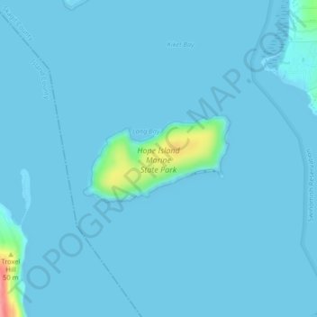
Name: Hope Island topographic map, elevation, terrain.
Location: Hope Island, Skagit County, Washington, United States (48.39507 -122.57862 48.40254 -122.55969)
Average elevation: 4 m
Minimum elevation: -2 m
Maximum elevation: 93 m
Thank you for supporting this site ❤️
Make a donation
Make a donation
Other topographic maps
Click on a map to view its topography, its elevation and its terrain.
Thank you for supporting this site ❤️
Make a donation
Make a donation
Thank you for supporting this site ❤️
Make a donation
Make a donation
Whitmarsh Junction
United States > Washington > Skagit County > Anacortes > Whitmarsh Junction
Average elevation: 15 m