
Thank you for supporting this site ❤️
Make a donation
Make a donation
Deer Park topographic map
Click on the map to display elevation.
Thank you for supporting this site ❤️
Make a donation
Make a donation
About this map
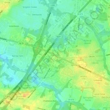
Name: Deer Park topographic map, elevation, terrain.
Average elevation: 20 m
Minimum elevation: 7 m
Maximum elevation: 36 m
Thank you for supporting this site ❤️
Make a donation
Make a donation
Other topographic maps
Click on a map to view its topography, its elevation and its terrain.
Cherry Hill Mall
United States > New Jersey > Camden County > Cherry Hill Township
Average elevation: 16 m
Cooper River Lake
United States > New Jersey > Camden County > Cherry Hill Township > Stoys Landing
Average elevation: 10 m