
Cherry Hill Mall topographic map
Interactive map
Click on the map to display elevation.
About this map
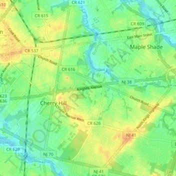
Name: Cherry Hill Mall topographic map, elevation, terrain.
Average elevation: 16 m
Minimum elevation: 1 m
Maximum elevation: 33 m
Other topographic maps
Click on a map to view its topography, its elevation and its terrain.
Willowdale
United States > New Jersey > Camden County > Cherry Hill Township
Willowdale, Cherry Hill Township, Camden County, New Jersey, 08003, United States
Average elevation: 25 m
Cooper River Lake
United States > New Jersey > Camden County > Cherry Hill Township > Stoys Landing
Cooper River Lake, Stoys Landing, Cherry Hill Township, Camden County, New Jersey, United States
Average elevation: 10 m
Deer Park
United States > New Jersey > Camden County > Cherry Hill Township
Deer Park, Cherry Hill Township, Camden County, New Jersey, 08003, United States
Average elevation: 20 m
Stoys Landing
United States > New Jersey > Camden County > Cherry Hill Township
Stoys Landing, Cherry Hill Township, Camden County, New Jersey, 08002, United States
Average elevation: 14 m
Locust Grove
United States > New Jersey > Camden County > Cherry Hill Township
Locust Grove, Cherry Hill Township, Camden County, New Jersey, 08003, United States
Average elevation: 25 m
Colwick
United States > New Jersey > Camden County > Cherry Hill Township
Colwick, Cherry Hill Township, Camden County, New Jersey, 08002, United States
Average elevation: 15 m