
Thank you for supporting this site ❤️
Make a donation
Make a donation
Brinnon topographic map
Click on the map to display elevation.
Thank you for supporting this site ❤️
Make a donation
Make a donation
About this map
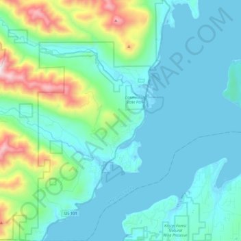
Name: Brinnon topographic map, elevation, terrain.
Average elevation: 204 m
Minimum elevation: -2 m
Maximum elevation: 1,186 m
Thank you for supporting this site ❤️
Make a donation
Make a donation
Other topographic maps
Click on a map to view its topography, its elevation and its terrain.
Thank you for supporting this site ❤️
Make a donation
Make a donation
Port Townsend
United States > Washington > Jefferson County > Port Townsend > Port Townsend
Average elevation: 18 m
Thank you for supporting this site ❤️
Make a donation
Make a donation