
铁岭市 topographic map
Interactive map
Click on the map to display elevation.
About this map
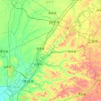
Name: 铁岭市 topographic map, elevation, terrain.
Location: 铁岭市, 辽宁省, 112700, 中国 (41.98940 123.44364 43.48889 125.10308)
Average elevation: 222 m
Minimum elevation: 40 m
Maximum elevation: 952 m
Other topographic maps
Click on a map to view its topography, its elevation and its terrain.