
Thank you for supporting this site ❤️
Make a donation
Make a donation
Al Ahsa Governorate topographic map
Click on the map to display elevation.
Thank you for supporting this site ❤️
Make a donation
Make a donation
About this map
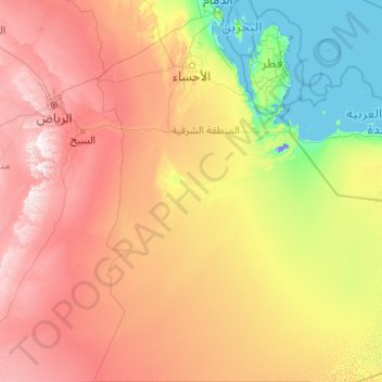
Name: Al Ahsa Governorate topographic map, elevation, terrain.
Location: Al Ahsa Governorate, Eastern Province, Saudi Arabia (19.33300 47.52440 26.60059 51.99754)
Average elevation: 287 m
Minimum elevation: -14 m
Maximum elevation: 1,159 m
Thank you for supporting this site ❤️
Make a donation
Make a donation
Other topographic maps
Click on a map to view its topography, its elevation and its terrain.
Thank you for supporting this site ❤️
Make a donation
Make a donation
Thank you for supporting this site ❤️
Make a donation
Make a donation