
Thank you for supporting this site ❤️
Make a donation
Make a donation
Alger topographic map
Click on the map to display elevation.
Thank you for supporting this site ❤️
Make a donation
Make a donation
About this map
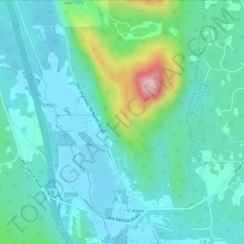
Name: Alger topographic map, elevation, terrain.
Location: Alger, Skagit County, Washington, United States (48.61590 -122.35616 48.64463 -122.32942)
Average elevation: 130 m
Minimum elevation: 72 m
Maximum elevation: 370 m
Thank you for supporting this site ❤️
Make a donation
Make a donation
Other topographic maps
Click on a map to view its topography, its elevation and its terrain.
Thank you for supporting this site ❤️
Make a donation
Make a donation
Thank you for supporting this site ❤️
Make a donation
Make a donation
Whitmarsh Junction
United States > Washington > Skagit County > Anacortes > Whitmarsh Junction
Average elevation: 15 m