
静安区 topographic map
Interactive map
Click on the map to display elevation.
About this map
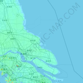
Name: 静安区 topographic map, elevation, terrain.
Location: 静安区, 上海市, 中国 (31.21630 121.41396 31.32321 121.47847)
Average elevation: 7 m
Minimum elevation: -4 m
Maximum elevation: 49 m
Other topographic maps
Click on a map to view its topography, its elevation and its terrain.