
Thank you for supporting this site ❤️
Make a donation
Make a donation
Mira topographic map
Click on the map to display elevation.
Thank you for supporting this site ❤️
Make a donation
Make a donation
About this map
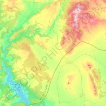
Name: Mira topographic map, elevation, terrain.
Location: Mira, Cuenca, Castile-La Mancha, Spain (39.56390 -1.56571 39.76772 -1.36853)
Average elevation: 917 m
Minimum elevation: 616 m
Maximum elevation: 1,410 m
Thank you for supporting this site ❤️
Make a donation
Make a donation