
绥棱县 topographic map
Interactive map
Click on the map to display elevation.
About this map
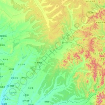
Name: 绥棱县 topographic map, elevation, terrain.
Location: 绥棱县, 绥化市, 黑龙江省, 152000, 中国 (47.04985 126.96854 48.09173 128.34367)
Average elevation: 324 m
Minimum elevation: 163 m
Maximum elevation: 973 m
Other topographic maps
Click on a map to view its topography, its elevation and its terrain.