
山泉镇 topographic map
Interactive map
Click on the map to display elevation.
About this map
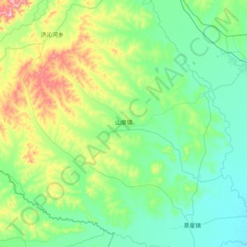
Name: 山泉镇 topographic map, elevation, terrain.
Location: 山泉镇, 龙江县, 齐齐哈尔市, 黑龙江省, 161000, 中国 (47.07562 122.51803 47.39197 123.10488)
Average elevation: 248 m
Minimum elevation: 161 m
Maximum elevation: 589 m
Other topographic maps
Click on a map to view its topography, its elevation and its terrain.