
南岔县 topographic map
Interactive map
Click on the map to display elevation.
About this map
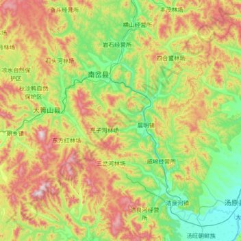
Name: 南岔县 topographic map, elevation, terrain.
Location: 南岔县, 伊春市, 黑龙江省, 153000, 中国 (46.60271 128.86034 47.37535 129.89236)
Average elevation: 408 m
Minimum elevation: 81 m
Maximum elevation: 1,197 m
Other topographic maps
Click on a map to view its topography, its elevation and its terrain.