
水 topographic map
Interactive map
Click on the map to display elevation.
About this map
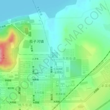
Name: 水 topographic map, elevation, terrain.
Location: 水, 东胜街道, 新富街道, 茄子河区, 七台河市, 黑龙江省, 154600, 中国 (45.77908 131.02906 45.78044 131.03100)
Average elevation: 208 m
Minimum elevation: 173 m
Maximum elevation: 293 m
Other topographic maps
Click on a map to view its topography, its elevation and its terrain.