
七台河市 topographic map
Interactive map
Click on the map to display elevation.
About this map
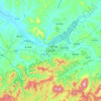
Name: 七台河市 topographic map, elevation, terrain.
Location: 七台河市, 桃山区, 七台河市, 黑龙江省, 中国 (45.61003 130.84750 45.93003 131.16750)
Average elevation: 269 m
Minimum elevation: 152 m
Maximum elevation: 687 m
Other topographic maps
Click on a map to view its topography, its elevation and its terrain.